GeoSpatial Solutions & Services

Mission & CoreValues

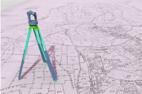
GIS Services & Map Production

Geoved LLC is a prominent GIS Company that provides multiple GIS services to clients all over the world. Our GIS mapping services provided by us allows the users to visualize geographical data, perform analysis and manage data efficiently.

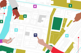
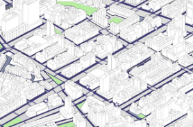
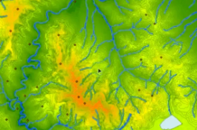
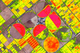
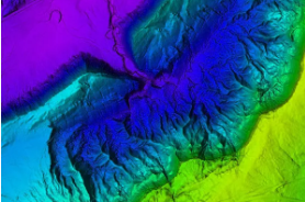
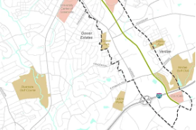
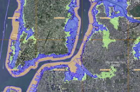
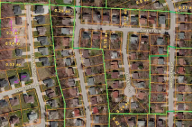
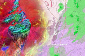
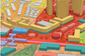
Being a GIS Company we work on data conversions and prepare Geo Spatial Maps with the help of GIS technology after utilizing the collected data. Our expertise allows us to integrate GIS services along with CAD services with the use of excellent GIS mapping and high-end GIS data conversions software. With the help of these services our customers can prepare spatial maps, atlas maps, contour maps, thematic maps, cadastral maps, landscape maps, zonal maps, and environmental maps.

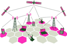
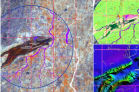
Our composite GIS Mapping services and remote sensing include acquiring, storing, integrating, analysing, displaying and manipulating the data.

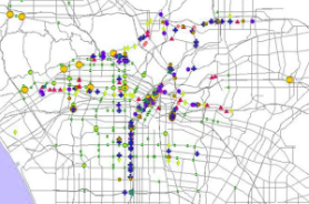
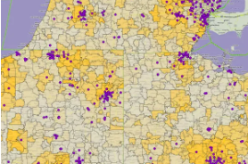
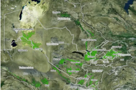
GIS mapping firms gather, organize and analyse spatial and non-spatial knowledge of a specific geographic location and provide the particular data in the form of dynamic maps. GIS services offer valuable inputs to unlock new and powerful insights on resource locations, consumer trends, demographic behavior, utility mapping and the other data referring to a specific place.

The Use of Data in GIS Services

Mapping Solution

GIS survey provide a perfect visual interpretation of data. Google Maps is an excellent example of a web-based GIS mapping solution used for navigation purposes.

Telecom and Network Services

Organizations incorporate GIS data to enhance telecom processes and ease complex network design, optimization, planning, and maintenance activities.

Accident Analysis and Hot Spot Analysis

GIS data helps to spot accident locations, and road networks are often optimized using data intelligence improveing road safety measures.

Urban Planning

GIS data analyzes urban growth and therefore the direction of expansion. Help discover new sites for future development, considering factors that are necessary for successful building.

Transportation Planning

GIS data assists in managing transportation issues. When incorporated with collected environmental and topical data companies plan new road or rail routes.

Environmental Impect Analysis

Data gathered via GIS applications assists in conservation of natural resources and protecting the environment by assessing the magnitude of human impect on the environment.

Agricultural Mapping

GIS survey data helps created more efficient and high yielding farming techniques, alongside analyzing soil data in an advanced fashion in turn increasing food production.

Disaster Management and Mitigation

An efficinet GIS system protects the environment and is developed to assist risk and disaster management which might occur if any.

Navigation

Web-based navigation maps use GIS data to supply the general public with useful information. Web maps are regularly updated as per GIS information.

Flood Damage estimation

Governments use GIS data to map flood risk areas and access information to coordinate relief efforts for the affected areas.

Natural Resources Management

Governments use GIS data to map flood risk areas and access information to coordinate relief efforts for the affected areas.

Banking

GIS data plays an essential role in planning, and decision making in the banking sector whitch has evolved as a market-driven industry.

Taxation

GIS enables the govt with building permits and engineering, in turn manageig property tax on a geographic area, solving taxation problems and maximizing government income.

Surveying

GIS surveying involves measuring the location of objects on earth, and Global Navigation Satellite System (GNSS) with GIS system for area estimation and preparing digital maps.

Geology

Geologists use GIS data to research soil, access seismic information, and make 3D display of geographic features. It also can be wont to analyze rock characteristics.

Assets Management & Maintenance

Asset management helps to analyze all the data for the work needed to perform ad maintenance helps to guide the physical performance of maintenance equipment and activities efficiently.

Planning ad Community Development

GIS data helps us understand and meet global challenges. As GIS technology rapidly advances, there are various innovative applications within the planing sector.

Irrigation Water Management

The availability of water directly affects crop production during a given region. GIS data can identify significant crops and determine yield, involvig efficient techniques for spatial and time domain.

Why you Choose Us ?

Grow Business

Identify opportunities, estimate accurately & bid with confidence.

Strategy

An intensive implentation system the science of ensuring future success.

Collaborate

Engage powerful with a visual language that bring your story to life

Visualization

COnverting you imagination in to a creative successful design

Quality

Quality is everyone's responsibility, never have to stopgetting better.

Deliverable

Scheduling a series of task for each successful project delivery.

As a leading GIS company, Geoved LLC extends its Geospatial and IT services to clients around the globe. Geoved partners and collaborates with various GIS Companies to provide tailored solutions and GIS mapping services for them years ahead of the whole race.

Geoved LLC with years of experience in GIS data conversion connects the dots and paves the path for the whole world for a better tomorrow. GIS mobile application is the service of tomorrow and Geoved understands the need of tomorrow.

Geoved LLC is a bright name when it comes to GIS services. Our dedicated and professional GIS team jumps into action and gets on with the GIS data.